


 Threats")

Strengthening Local Capacities against natural hazards in Afghanistan

To expand reach and strengthen the role of academic institutions in disaster risk management, Community World Service Asia (CWSA) and MoFA-Japan collaborated with local stakeholders to establish a Disaster Risk Reduction (DRR) Training Workstation at the Kabul University in 2021. This facility provides a platform to conduct DRR and emergency preparedness training that aim to provide students and aid practitioners with information on DRR, its preventive measures and technology updates. The work station helps key stakeholders such as government agencies, community structures, CSOs and academia identify and understand their relevant roles and responsibilities.
A six-day Technical Training on QGIS and Risk Assessment was conducted at this Workstation for ten participants representing the Afghan government and academia in May (2022). The sessions focused on enhancing the knowledge of participants on floods, debris flows, and landslides risks, while particularly raising awareness on the linkages between natural disasters, surveys, and risk analysis. Participants were also introduced to the QGIS software, contour maps, and how to use them for effective DRR analyses of hazardous regions.
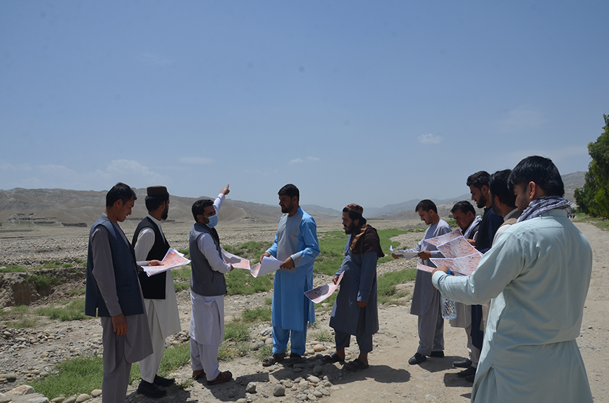
During the training, participants created contour maps and assessed the risks associated with natural hazards such as floods and landslides. They also compared their contour maps to the terrain in a field exercise to ensure their application. “During the field study, we gathered information about previous disasters from the communities. We learned how to collect information and turn contour maps into hazard maps owing to the information we got from the community,” explained Wasiqullah Ahmadi, a participant.
“Afghanistan is among the countries most hit by concurrent disasters. Such workshops are critical for us to develop strategies that will aid us in mitigating the damage caused by these calamities. The knowledge gained through generating contour and hazard maps will be extremely valuable to the areas in which we operate,” remarked Wasiqullah.
“The QGIS technical training offered by CWSA was quite educational and valuable. I gathered knowledge on both theoretical and practical methods for creating contour maps and analysing them. I am better aware of how to use the QGIS programme to detect risky regions and create hazard maps. In addition, I am also now able to create scales and legends for maps,” shared Sharifullah, another participant.
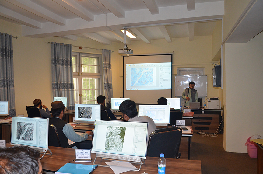
Handouts, instructional videos, and other reference material was provided to participants so that they could share the information with others and further research to understand and enhance their risk reduction expertise. Community World Service Asia (CWSA) and MoFA-Japan have collaborated on implementing DRR activities under their Disaster Risk Reduction project to minimise and mitigate the risk of displacement and strengthen community resilience against disasters. The projects are active in Kabul, Laghman and Nangarhar provinces of Afghanistan, targeting all key stakeholders such as communities, government bodies and academic representatives. The DRR workstation, furnished with all necessary resources and technological equipment, has the capacity to accommodate 10 trainees in a session and has already hosted a number of training sessions in 2021

