


Strengthening the capacity of disaster affected communities and other key stakeholders on DRR in Afghanistan

Community World Service Asia, with the support of Ministry of Foreign Affairs, Japan, is implementing the second phase of a Disaster Risk Reduction (DRR)[1] project in three most disaster-prone areas of Afghanistan- namely Nangarhar, Laghman and Kabul. The project aims to reduce the risks of affected communities against flood and landslide and build their capacity to be better prepared in the face of natural hazards.
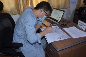
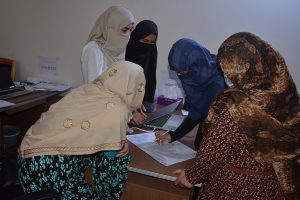
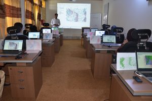
As a key component of the project’s capacity building aspect, a five-day training to enhance the capacity of affected community members, relevant government officials, DRR officials, and university students on reducing risks of damages from hazards and increasing their resilience against disasters was conducted in June in Jalalabad. Training participants learned about DRR Risk Analysis, QGIS[2] and the method and need of developing hazard maps. Eight participants, including community members, Provincial Disaster Management Authority staff, Engineering faculty of Nangarhar University and staff of National Water Affairs Regulation Authority (NWARA) of Laghman and Nangahar, attended the first session of these trainings The training was facilitated by the Community World Service Asia’s DRR team.
Irshad Darmal, Site Engineer, led one of the sessions on ‘QGIS Settings,’ in which participants learned about DRR Analysis and other related information.
“The QGIS tool will prove to be extremely beneficial as the software we previously utilised is quite extensive and complex to use, especially for a new user. We will be able to develop useful maps that will allow us to investigate streams and water flowage areas,” shared Mohammad Inam Azami, Irrigation Manager at NWARA Laghman Directorate
Participants learned how to build a new climate-related project, link the project’s Coordinates Reference System (CRS) to a specific place, and how to operate and produce a map. In the ‘DRR Analysis’ session, participants strengthened their knowledge and skills on identifying yellow zones and risk-prone regions based on topographical factors. Participants further discussed how to grade their map and its appearance based on different aspects of the foundation map during the ‘Creating Gradation Map’ session.
To make the training more engaging through practical learning, group exercises were conducted. Participants used contour maps to recognise numerous topographic features based on the contour lines on the map in these sessions. They learned about the geology of the area and discussed the many geographic characteristics present above and below sea level. On the contour maps, participants identified regions at risk of flash floods and landslides. They explored different symbols and features that may be used to identify site risks and vulnerabilities in greater depth.
As a civil engineering graduate, I am fully dedicated to working on climate-related projects,” shared Nadia Omari, training participant, “This workshop provided a wealth of information on disaster risk reduction and how to mitigate the susceptibility of risk-prone regions. When I start working on my project, I plan to fully apply and implement the learnings of this training in my work. On the other hand, I have started to create a hazard map of my neighbourhood to be more aware of the possible disaster risks and explore solutions to reduce the consequent damage.”
To ensure comprehensive learning on the topics, additional study and reference, all training participants were provided relevant learning materials and videos. An online platform in the form of a WhatsApp group was also created to allow participants to engage with one another, stay connected and share information while continuing the learning process.
[1] Disaster Risk Reduction
[2] QGIS (until 2013 known as Quantum GIS) is a free and open-source cross-platform desktop geographic information system (GIS) application that supports viewing, editing, and analysis of geospatial data.

