

 Threats")


Scaling-up knowledge and action on Disaster Risk Reduction in Afghanistan

Disaster Risk Reduction Need & Response in Afghanistan
Afghanistan is one of the most disaster-prone countries in the world, with nearly all of its 34 provinces affected by at least one natural disaster over the past 30 years[1]. As well as the high toll of death and displacement due to disasters, thousands have been injured, killed or forced to flee their homes as a result of the country’s longstanding conflict. Over the last decade, DRR has become a significant concern for the international aid community and the Afghan people.
Disaster Risk Reduction (DRR) activities help build the resilience of local communities’ to natural disasters in disaster-prone areas of Afghanistan. Prevalent poor construction practices combined with a history of recurring natural disasters in Afghanistan create a need for DRR techniques to be integrated into emergency response and recovery activities, particularly those related to shelter reconstruction and rehabilitation of key lifesaving infrastructures.
Through its Disaster Risk Reduction projects, Community World Service Asia (CWSA) directly implements DRR activities to reduce and mitigate the risk of displacement and increase the resilience of communities to cope with disasters. A project conducted in Kabul and Nangarhar with the support of the Ministry of Foreign Affairs – Japan, aims at increasing DRR capacity of community members, and all other relevant stakeholders including government bodies and academia representatives against floods and landslides.
Enhancing skills on QGIS[2] and Risk Assessment
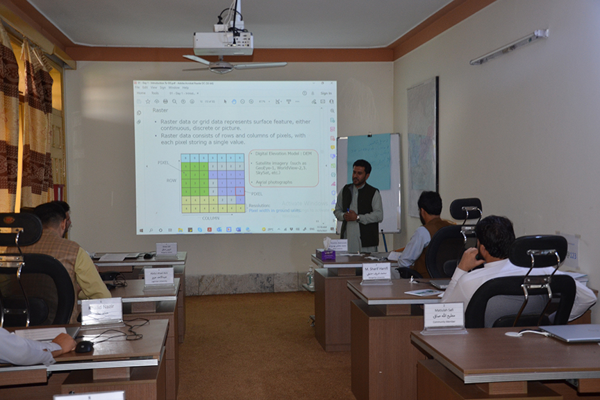
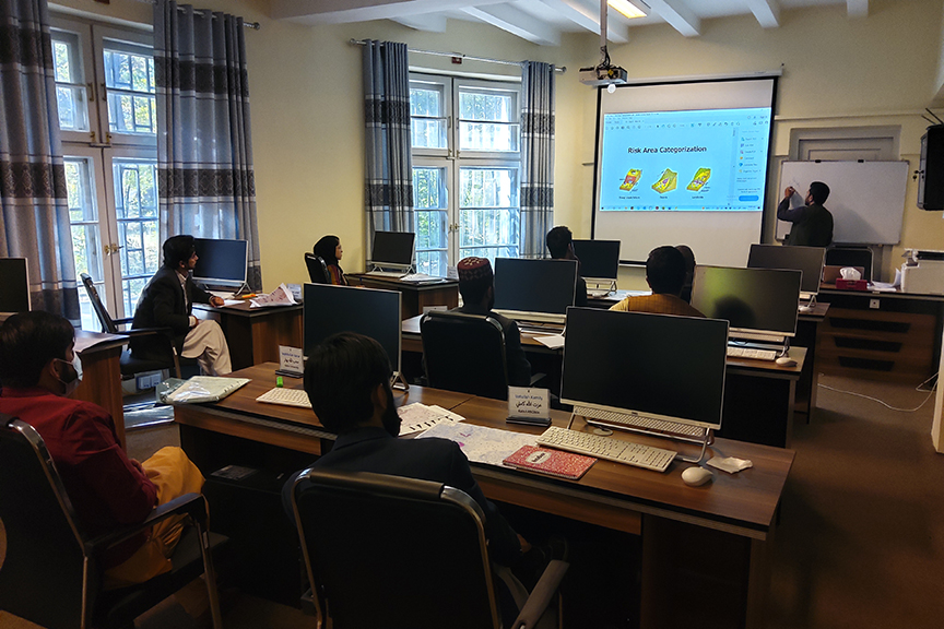
To strengthen capacity and coordination among communities, CWSA’s DRR team organised two technical training workshops in Kabul and Jalalabad. A total of 18 members from ANDMA[3], NWARA[4], academic institutions, and affected communities participated in the 6-day technical training in October this year.
The training focused on increasing participants’ understanding on climate and disaster risk guided by explicit emphasis on the links between natural hazards, surveying and risk analysis. Participants were familiarised with QGIS software, contour maps and DRR analysis in risk-prone areas.
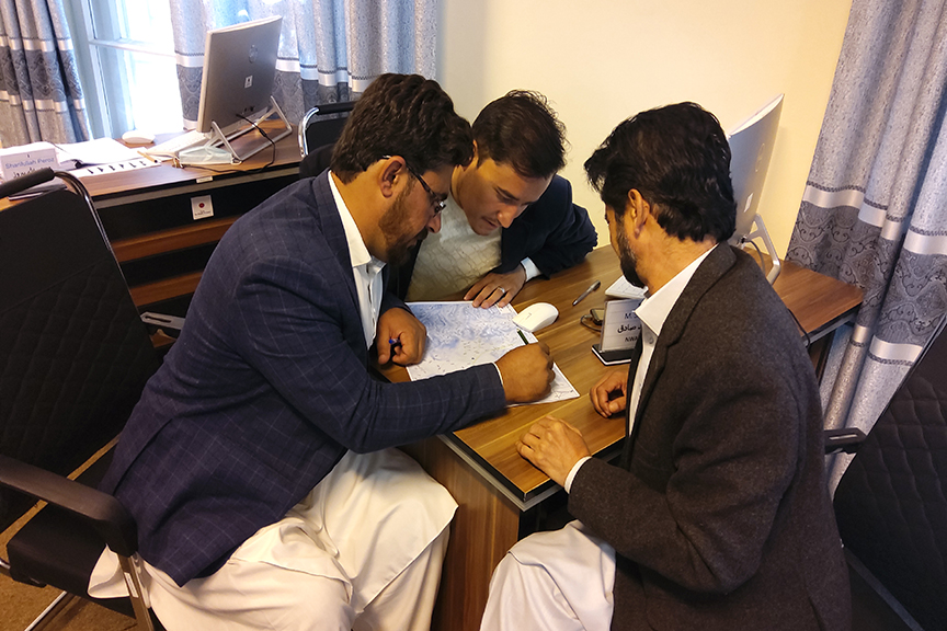
Participants were provided with hands-on experience of using the QGIS software. During the course of the training, participants developed contour maps and analysed the risks associated with natural hazards including floods and landslides.
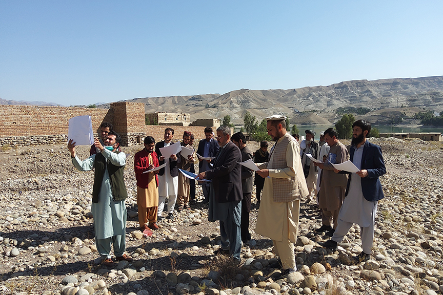
Participants were also taken out into the field to compare contour maps to actual landscapes and assess their applicability. During the field session, participants engaged with local communities and learned about disasters that have occurred in the region. The information allowed participants to go back to the workshop and develop hazard maps for the local communities. Participants in the workshop emphasized on the need to immediately develop such hazard maps for their villages and the areas they belong to. This would enable them to learn key information that would help their community understand the risks associated with natural hazards and how to mitigate them. Hazard maps also indicate the extent of expected risk areas, therefore information from it can be combined with disaster management information such as evacuation sites, evacuation routes, and so forth to be most effective.
Handouts, videos, and other reference materials were provided to participants to share further with communities, colleagues and students.
Participants’ Voices:
“I found it fascinating to use QGIS to create contour and hazard maps. Natural catastrophes wreak havoc on remote, risk-prone regions, and these maps will help to minimise the damage. The communities’ lack of disaster management expertise prevents them from successfully combating natural disasters. I’ll share my experience with students at Kabul University so that they may have a basic understanding of how to deal with calamities.” Sharifullah, Kabul University
“Using QGIS, I learnt how to convert a paper-based map into a digital map, namely contour maps. Our field trip to disaster-prone locations taught us how to gather critical information about natural disasters and how to incorporate that knowledge into hazard maps.” Mirwais Sediqi, ANDMA Kabul
“I had never worked on hazard maps before. The information regarding the area, perimeter, and geographical position of disaster-affected regions may be digitised in QGIS software. Communities can create and implement these plans with the goal of recognising, analysing, and reducing the long-term risk to life and property from hazard occurrences.” M. Idrees Safi, ANDMA Nangarhar
“The QGIS technical training organized by CWSA was very informative and useful. I gathered information on theoretical and practical ways to develop contour maps and how to analyse it. I am more aware on how to identify risk prone areas and develop hazard maps using the QGIS software. Additionally, I am able to formulate the scales and legends on the maps.” Basira Azami, Community Representative, Laghman
[1] https://cdn.odi.org/media/documents/12883.pdf
[2] Quantum Geographic Information System
[3] Afghanistan National Disaster Management Authority (ANDMA)
[4] National Water Affairs Regulation Authority (NWARA)

 Threats")